

FEMA Flood Map Appeal Process Steps for Homeowners

Most single-property disputes do not require a formal appeal. If FEMA’s Flood Insurance Rate Map (FIRM) shows your lot or structure inside a Special Flood Hazard Area (SFHA) and you believe that designation is wrong, a Letter of Map Amendment (LOMA) or Letter of Map Revision Based on Fill (LOMR-F) is almost always the correct route. The formal 90-day community appeal is reserved for community-scale technical challenges to FEMA’s flood modeling or methodology, not individual parcel corrections.
Here is the short version before we go deeper:
- Which process to use: LOMA for structures or lots that were never truly in the SFHA; LOMR-F when fill has raised the site to or above the Base Flood Elevation (BFE).
- Expected response time: Notice of completeness within roughly 30 days; final determination within roughly 60 days after FEMA receives a complete package.
- Fees: LOMA carries no FEMA review fee. LOMR-F does carry a fee.
- Fastest first action: Pull your current FIRM panel from the FEMA Map Service Center (MSC) and call your community’s floodplain administrator today.
Table of Contents
- Which FEMA pathway is right for your situation?
- Step-by-step: how to prepare and submit a LOMA or LOMR-F
- How does the 90-day preliminary appeal period work?
- What documents does FEMA actually require?
- What causes delays and denials, and how do you avoid them?
- What happens after FEMA issues its determination?
- Key Takeaways
- What I tell Louisiana homeowners about flood map disputes
- The Root Agency can help while your map change is in progress
- Useful FEMA sources and forms to bookmark
Which FEMA pathway is right for your situation?
Choosing the wrong process wastes months. The table below maps each pathway to its purpose, who can file, what data FEMA needs, and what you can realistically expect at the end.
| Process | Purpose / When to use | Who may submit | Data required | Fees and timeline | Expected outcome |
|---|---|---|---|---|---|
| LOMA | Lot or structure was never truly in the SFHA; no fill involved | Individual property owner or licensed professional | Elevation Certificate, certified survey, legal description, site photos | No FEMA fee; ~30-day completeness notice, ~60-day determination | Parcel or structure removed from SFHA |
| LOMR-F | Fill has raised the lot or structure to or above the BFE | Individual property owner with PE/LLS certification | Elevation Certificate, fill certification, community floodplain determination, engineering data | FEMA fee applies; same ~30/~60-day windows | Lot or structure removed from SFHA based on fill |
| LOMR | Widespread map revision affecting multiple parcels or a reach of a waterway | Community official or licensed engineer | Hydraulic/hydrologic modeling, engineering analysis, community coordination | Fees apply; timeline varies by complexity | Map revised for affected area |
| CLOMR/CLOMA | Conditional approval before a project is built or fill is placed | Community official or project engineer | Proposed project data, engineering analysis | Fees apply; timeline varies | Conditional letter confirming future eligibility |
| 90-day community appeal | Technical errors in preliminary FIRM methodology or modeling | Community CEO or designated official (not individual owners) | Scientific/technical evidence showing preliminary determinations are incorrect | No direct fee to property owner; community coordinates | Map corrected at community scale; SRP available for unresolved disputes |
The rule of thumb: if your dispute is about one lot or one structure, start with a LOMA or LOMR-F. If the preliminary map misrepresents an entire neighborhood or watershed, your community’s floodplain administrator is the right first call.
Step-by-step: how to prepare and submit a LOMA or LOMR-F
This is the path most Louisiana homeowners will follow. Work through these steps in order and you will avoid the most common delays.
Step 1: Verify your FIRM panel and SFHA status
Pull the current effective FIRM panel for your property from the FEMA Map Service Center. Confirm the flood zone designation, the panel number, and the effective date. If your structure or lot appears inside a Zone A, AE, AH, AO, or VE, you are in the SFHA and may have grounds for a map change.
Step 2: Choose the correct form and submission method
Applications can be submitted via Online LOMC or paper forms (MT-EZ, MT-1); certified elevation data such as an Elevation Certificate is required for both routes.
- Online LOMC: — FEMA’s web portal for uploading documents, paying fees, and tracking status. Preferred over mail.
Step 3: Hire a Licensed Land Surveyor or Registered Professional Engineer
An Elevation Certificate prepared by a Licensed Land Surveyor (LLS) or Registered Professional Engineer (PE) is the single most critical document in your package. Missing or incorrect elevation data is the most common reason FEMA delays or rejects applications. Ask your surveyor to reference the same vertical datum as the FIRM and to report elevations to the nearest tenth of a foot.
Step 4: Assemble your complete document package
- Completed MT-EZ or MT-1 form (signed and dated)
- Elevation Certificate stamped and signed by your LLS or PE
- Certified boundary survey and legal description of the property
- Site photographs showing the structure and surrounding grade
- For LOMR-F: fill certification, community floodplain administrator’s determination, and any engineering data supporting the fill placement
Pro Tip: Submit everything as one complete package. FEMA’s completeness clock does not start until all required items are received. A partial submission resets the timeline.
Step 5: Submit and pay any applicable fees
Upload through Online LOMC or mail your paper forms to FEMA’s designated processing address listed on the MT-1 or MT-EZ instructions. LOMR-F requests require a fee payment at submission. LOMA requests do not.
Step 6: Track your application
FEMA will issue a notice of completeness within approximately 30 days and a final determination within approximately 60 days after receiving a complete submittal. Monitor your status through the Online LOMC portal or the FEMA Map Service Center.
Timeline snapshot: ~30 days to completeness notice, ~60 days to determination after complete package received. These windows can extend if FEMA requests additional data.
How does the 90-day preliminary appeal period work?
When FEMA issues a preliminary FIRM or Flood Insurance Study (FIS) report, a statutory 90-day appeal period opens. Local notices published in the community newspaper (two printings) start the clock. This process is distinct from a LOMA or LOMR-F and operates at the community level.
Here is what property owners need to know:
- Appeals go to the community first — Submit your appeal to the community CEO or designated community official within the 90-day window, not directly to FEMA. The community consolidates all appeals and forwards them to FEMA.
What documents does FEMA actually require?
Documentation quality determines whether your application succeeds or stalls. Here is what FEMA needs and who must produce each item.
Required for LOMA (MT-EZ or MT-1):
- Elevation Certificate completed and stamped by a Licensed Land Surveyor or Registered Professional Engineer
- Certified boundary survey with legal description
- Site photographs (exterior of structure, surrounding grade, drainage features)
- Copy of the relevant FIRM panel showing the property location
Additional items required for LOMR-F (MT-1):
- Fill certification from a PE confirming the fill was placed properly
- Community floodplain administrator’s written determination that the fill meets NFIP standards
- Engineering data if the fill affects drainage patterns or adjacent properties
FEMA publishes MT-EZ, MT-1, and MT-2 form packages with detailed checklists and instructions. Download the checklist for your specific form type and use it as a pre-submission audit.
Pro Tip: Before hiring a surveyor, confirm they are familiar with FEMA’s vertical datum requirements. Ask specifically whether they will reference NAVD 88 (the datum most current FIRMs use) and whether they will complete all sections of the Elevation Certificate, including the community name, FIRM panel number, and flood zone.
The LOMA and LOMR-F tutorials on FEMA’s site walk through each form section with annotated examples. If your property was built on fill, confirm whether that fill predates the first NFIP map showing your area in an SFHA. Fill placed before the earliest NFIP map may be treated differently for LOMR-F eligibility purposes.
| Document | Who produces it | Professional certification required? |
|---|---|---|
| Elevation Certificate | Licensed Land Surveyor or PE | Yes — stamp and signature |
| Certified boundary survey | Licensed Land Surveyor | Yes — stamp and signature |
| Fill certification | Registered PE | Yes — stamp and signature |
| Site photographs | Property owner | No |
| FIRM panel copy | Property owner (from MSC) | No |
| Community floodplain determination | Community floodplain administrator | Yes — official signature |
What causes delays and denials, and how do you avoid them?
FEMA’s most common reasons for returning applications incomplete:
- Wrong datum. Elevations reported in NGVD 29 when the FIRM uses NAVD 88, or vice versa.
- Incomplete Elevation Certificate. Missing sections, unsigned, or not stamped by a licensed professional.
- Missing legal description. A street address alone is not sufficient.
- Partial packages. Submitting the form without the Elevation Certificate, or the certificate without the survey.
- Wrong form type. Using MT-EZ for a LOMR-F request, or MT-1 when eLOMA would apply.
- Unpaid LOMR-F fee. FEMA will not begin review until the fee is received.
- Conflicting data. Submitting one elevation in the form and a different elevation in the certificate.
Administrative pitfalls to avoid:
- Skipping the community floodplain administrator. Many communities offer a pre-review that catches errors before FEMA sees the package.
- Sending multiple partial packages instead of one complete submission.
- Failing to coordinate with your insurance agent and lender before submitting, so they are ready to act quickly once a determination arrives.
Pro Tip: Before you hit submit, run through FEMA’s published completeness checklist for your form type. One missing signature or one wrong datum reference can add 30 or more days to your timeline.
What happens after FEMA issues its determination?
A FEMA determination letter is not the finish line. It is the starting point for a series of administrative steps that actually change your insurance obligations.
If your request is approved
- Notify your mortgage lender immediately. Lenders are not automatically informed when FEMA issues a determination. You must present the FEMA letter directly to your lender and formally request removal of the mandatory flood insurance requirement. Your flood insurance policy and lender escrow may both need updating.
If your request is denied
Read the denial carefully. FEMA’s denial letters identify the specific data gap or technical deficiency that prevented approval. Common fixable issues include datum mismatches, insufficient fill certification, or a structure whose lowest adjacent grade is still below the BFE.
- Consult your LLS or PE about correcting the specific deficiency and resubmitting.
- If the issue affects multiple parcels, consider whether a community-level appeal or LOMR is more appropriate.
- Judicial review is a legal option of last resort, but it is rarely the right first response to a technical denial. Fix the data first.
Knowing whether you need flood insurance in Baton Rouge even after a favorable determination is a conversation worth having with your agent. Many Louisiana homeowners outside the SFHA still carry voluntary flood coverage, and for good reason.
Key Takeaways
Choosing the right FEMA pathway, assembling certified documentation, and acting on the determination letter are the three steps that determine whether a map-change request succeeds.
| Point | Details |
|---|---|
| LOMA vs. LOMR-F | Use LOMA when no fill is involved; use LOMR-F when fill raised the site to or above the BFE. |
| Fees and timelines | LOMA carries no FEMA fee; LOMR-F does. Expect a completeness notice in about 30 days and a determination in about 60 days after a complete package is received. |
| Documentation quality | An Elevation Certificate stamped by a Licensed Land Surveyor or PE, referencing the correct vertical datum, is the most critical document in any submission. |
| After approval | Present the FEMA determination letter directly to your lender; lenders are not automatically notified to remove mandatory flood insurance. |
| The Root Agency | The Root Agency helps Louisiana homeowners translate FEMA determinations for lenders, update flood insurance policies, and manage coverage while a map change is pending. |
What I tell Louisiana homeowners about flood map disputes
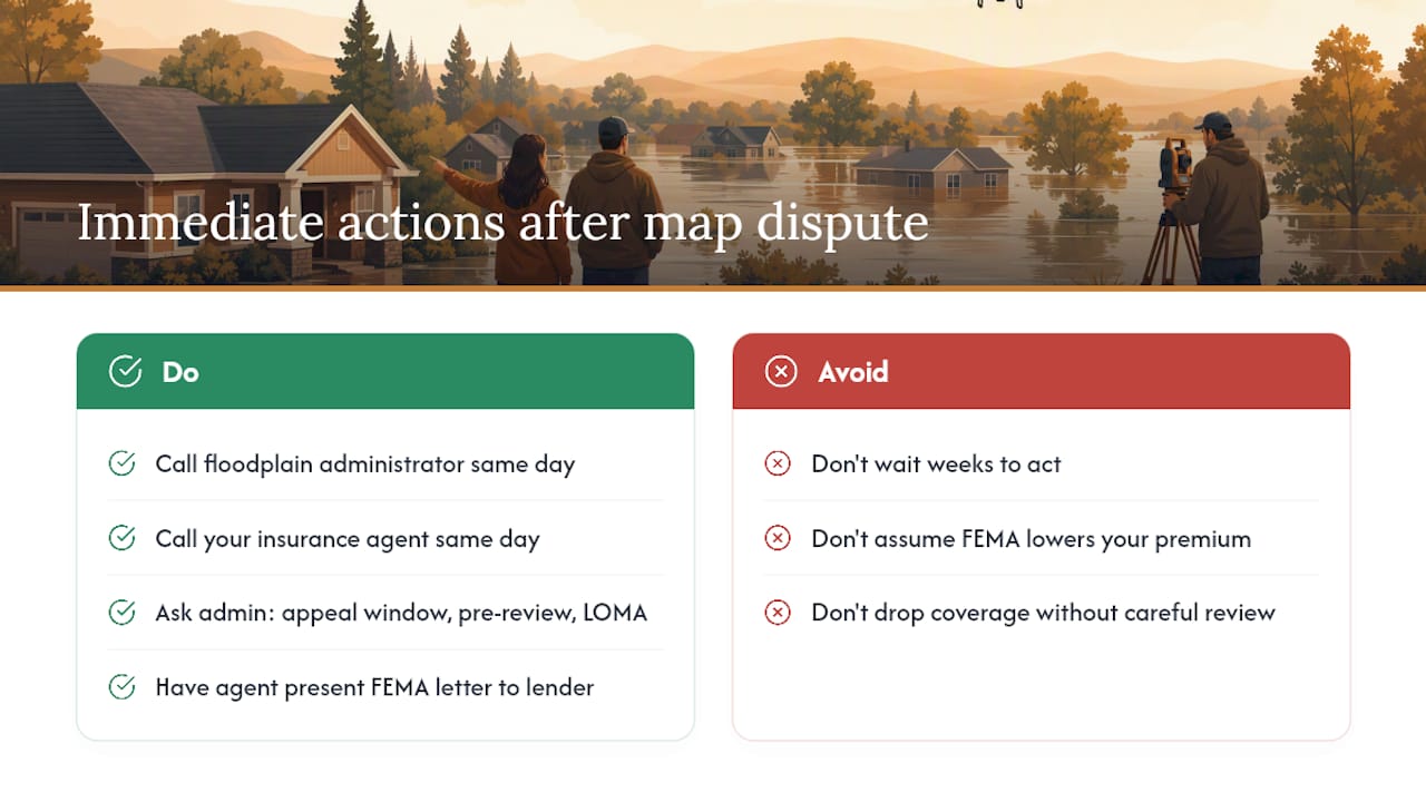
Most of the homeowners who call us after a flood map dispute have already spent weeks trying to figure out which FEMA form to use. The confusion is understandable. FEMA’s system has multiple pathways, and the terminology overlaps in ways that are genuinely confusing. What I have seen over more than 20 years in Louisiana is that the property owners who move fastest are the ones who call their floodplain administrator and their insurance agent on the same day they discover the problem.
The floodplain administrator knows the local map history. They can tell you whether a preliminary map is still in the appeal window, whether your community has a pre-review process, and whether your lot’s elevation data is likely to support a LOMA. That conversation costs nothing and can save months.
The insurance piece matters just as much. A favorable FEMA determination does not automatically lower your premium or satisfy your lender. Someone has to take that letter, present it correctly, and follow through with the underwriter and the mortgage servicer. That is where a local agent earns their place. We have done this for clients across Louisiana, and we know exactly what lenders need to see and how quickly they are required to respond.
Louisiana sits in the bullseye for flood risk. Even homeowners who successfully exit the SFHA often choose to keep voluntary flood coverage, because they have seen what a storm can do to a property that was “technically” outside the flood zone. Getting off the mandatory purchase requirement is worth pursuing. Dropping flood coverage entirely is a different decision, and one worth making carefully.
The Root Agency can help while your map change is in progress

Pursuing a FEMA map change takes months. During that time, your lender may still require flood insurance, your current policy may be mispriced for your actual risk, and you may need someone to coordinate between your surveyor, your mortgage servicer, and your underwriter. That is exactly where The Root Agency steps in.
We help Louisiana and Mississippi homeowners review their current flood insurance coverage, place new policies, and present FEMA determination letters to lenders in the format lenders actually accept. We offer bilingual service in English and Spanish, 24/7 claims support, and a mobile catastrophe response unit that deploys directly to disaster zones when a storm hits. We do not perform FEMA mapping determinations — FEMA does. But we handle every insurance and lender step that follows.
Call us at (225) 926-0160 or visit our free mortgage calculators and tools to request a policy review. If your flood zone status is changing, now is the right time to make sure your coverage reflects it.
This article is general information, not legal or regulatory advice. Confirm current FEMA procedures and eligibility requirements with FEMA directly or with a qualified floodplain management professional.
Useful FEMA sources and forms to bookmark
The resources below are the authoritative starting points for any LOMA, LOMR-F, or appeal submission.
- Change Your Flood Zone Designation
- Letter of Map Amendment / Letter of Map Revision — Based on Fill Tutorials
- Appeal and Comment Processing Procedures
- Online Letter of Map Change — sign-in and support
| Resource | Best used for |
|---|---|
| Online LOMC portal | Submitting applications, paying fees, tracking status |
| FEMA Map Service Center (MSC) | Viewing current FIRM panels and flood hazard notices |
| MT-EZ form package | Single-lot LOMA requests |
| MT-1 form package | LOMR-F requests and multi-lot submissions |
| MT-2 form package | Conditional requests (CLOMR/CLOMA) |
| 1-877-FEMA-MAP | Technical support for Online LOMC system errors |
| Community floodplain administrator | Pre-review, local map history, 90-day appeal coordination |